|
Te Araroa,
New Zealand 2020 |
|
Finding the Opera House Hut has been Michelle’s dream since 2016. She did all the planning, bought the maps and prepared all the food herself; so it is only natural that I, Mickey should be the one to tell this story.
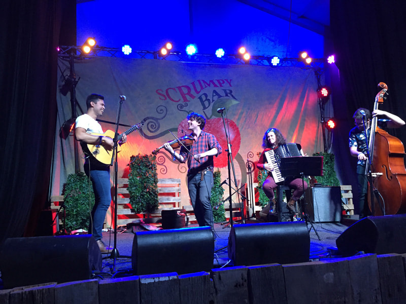
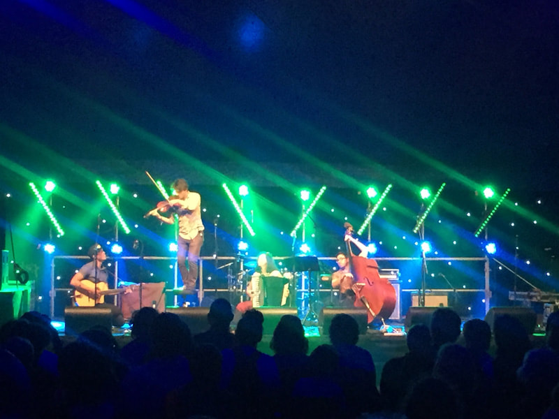
I had nobly left Michelle for two weeks of rehearsals and gigging in Sydney, and the National Folk Festival in Canberra with my beloved Squeezebox Trio. We were a huge hit, and some young women even told us they’d started a cover band after seeing us perform in 2015! But enough about how marvelous we were (which we were), the point I’d like to impress upon you is how I had boldly let Michelle do all the work, while enjoying the rockstar life – only to be whisked away after our final performance to Mt. Kosciuszko.
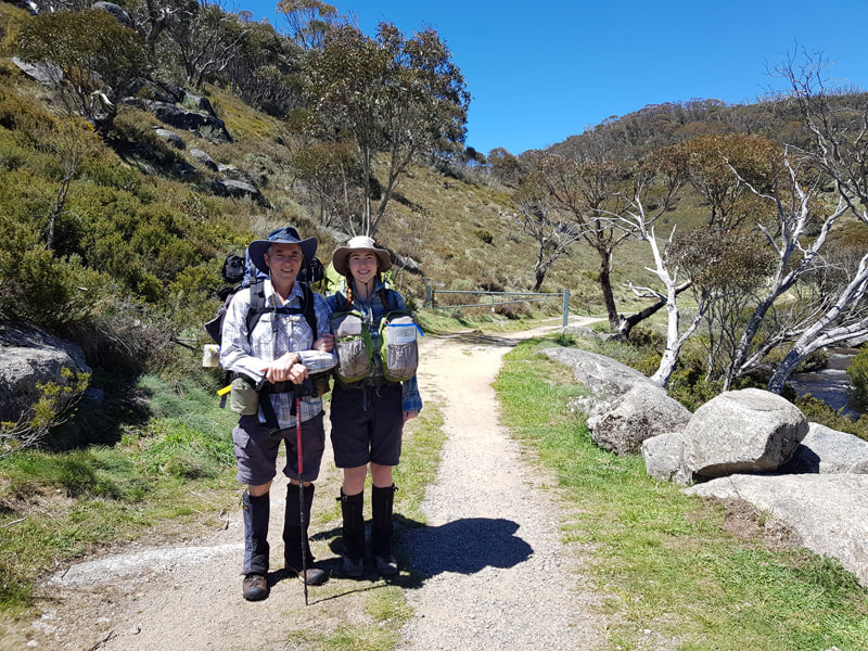
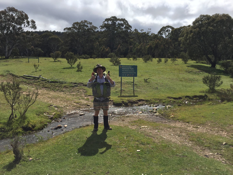
We drove from Canberra to Thredbo on Easter Monday and jumped straight onto the chairlift that allows you to skip 550m of elevation. We needed the boost as we had bigger fish to fry the next day and little remaining light - it wouldn’t be Mickey & Michelle if we didn’t start a hike racing sundown and the inevitable ‘head torch walk’ into camp.
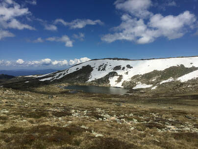
This was the first time I had been back to Kosciuszko since my first hike on the AAWT and I’m pleased to tell you this time I didn’t feel like vomiting. The first day wasn’t too long, 6kms till we went off the track to Wilkinson’s Creek for an early sleep before the big adventure really began.
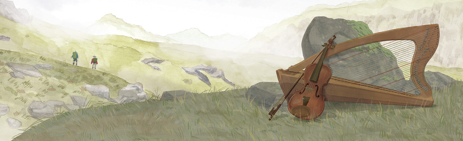
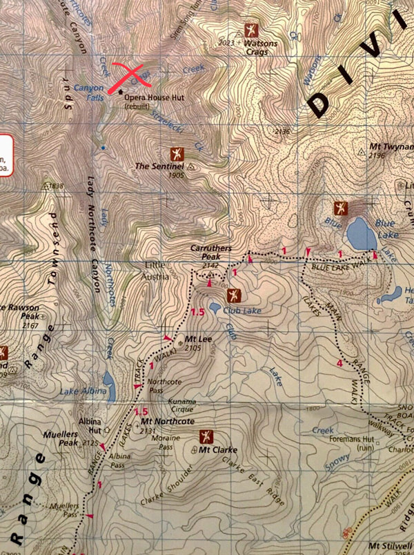
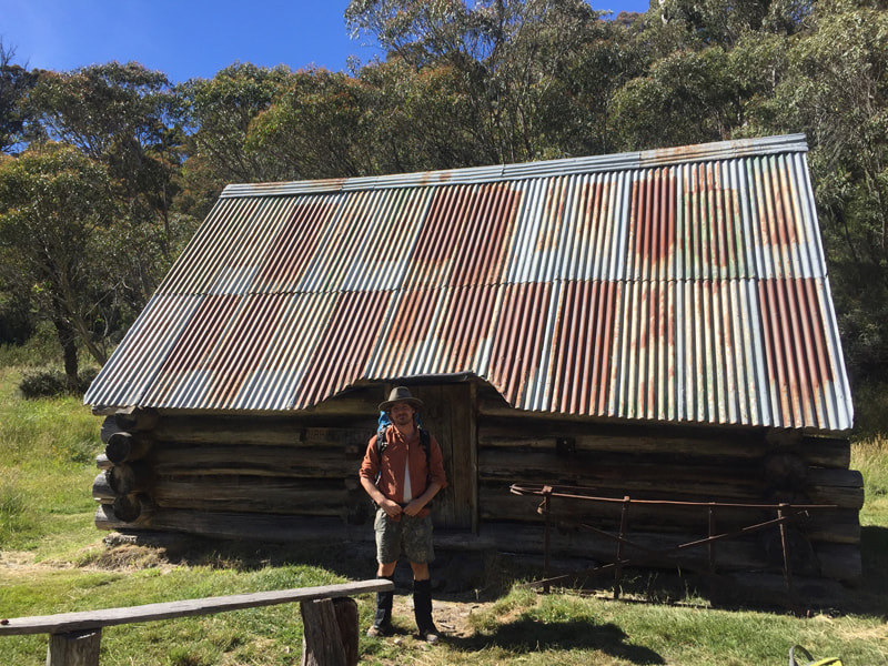
Next morning and it’s Michelle’s birthday! Hooray, I gave her some socks my mum knitted and we celebrated with a lavish breakfast of oats and chia…well at least she liked the socks. But we were going to need our energy if we were to find the fabled Opera-House, named so because it cost more per square meter to build than the actual one in Sydney. It was built by the SMA in 1966 to manage water aqueducts, accessible only by a tunnel from Siren Song or helicopter. The tunnel is now prohibited by the Snowy Hydro so there’s no track to it (now you see why Michelle likes it..)
There are supposedly three ways to find the hut:
We chose the rock scramble.
We were nervous because the man Mish had bought the maps from warned her off trying saying it was dangerous and difficult, but on the other hand the weather report looked great and she had heaps of birthday luck, so it felt like pretty even odds.
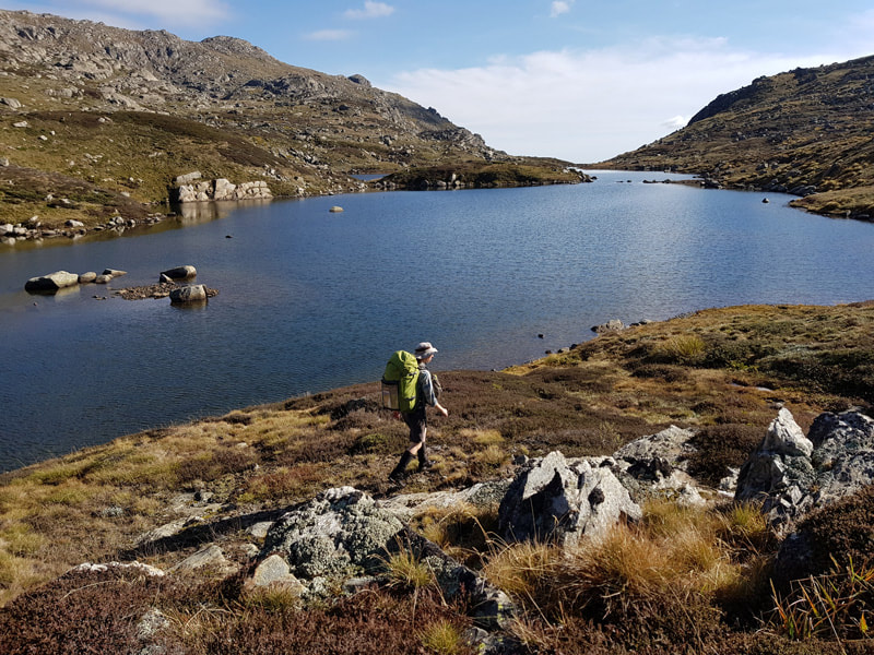
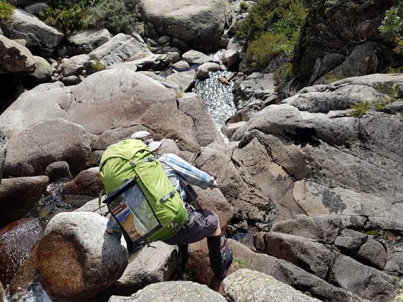
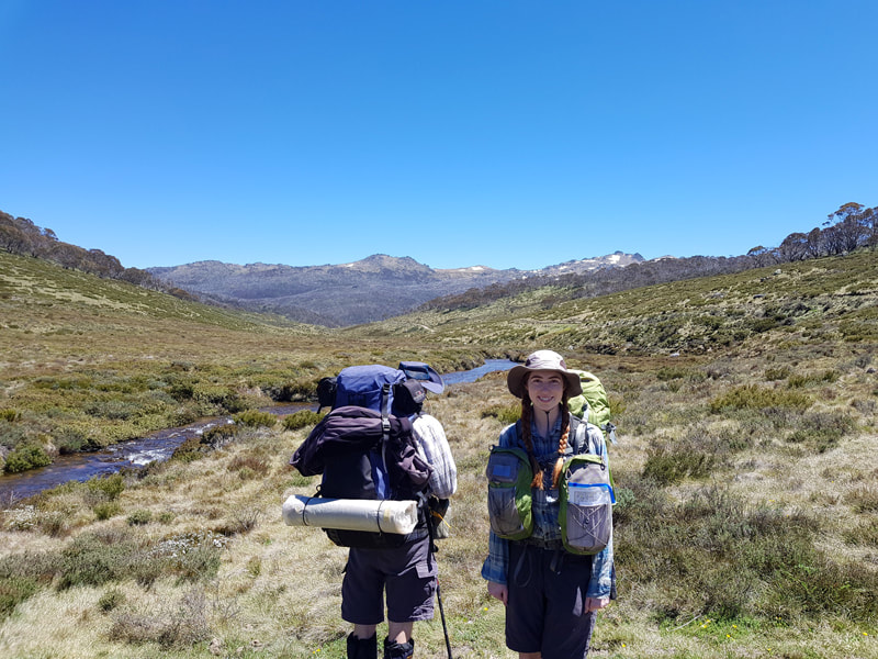
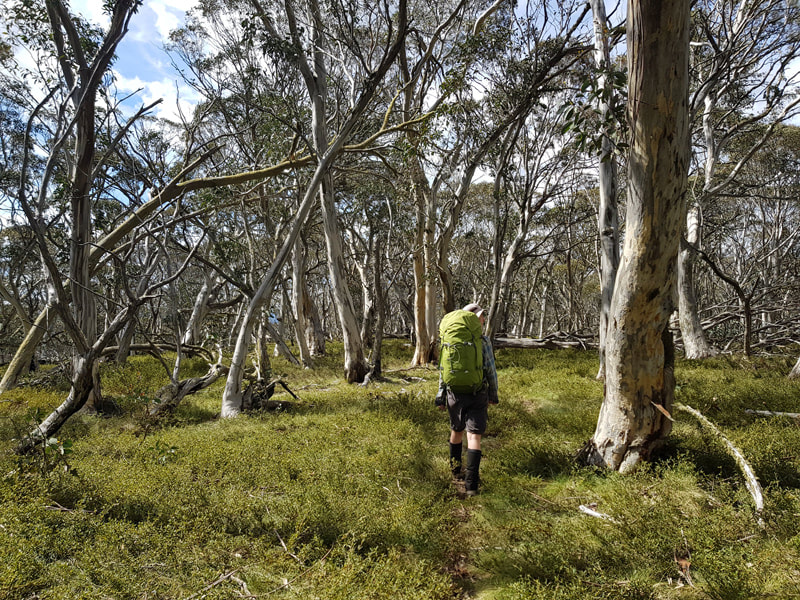
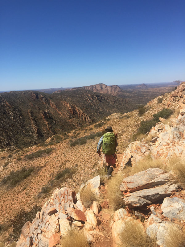
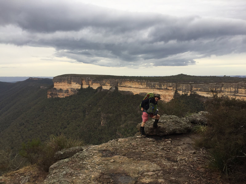
We set off early that morning, passed the absolutely beautiful lake Albina (which I had really wanted to get close to after seeing on our first hike), and down LNC. What can I say about that rock scramble, except that it was probably my favourite time hiking! I don’t have particularly long legs, nor am I very tall, so while I am not genetically predisposed to flying up a mountain, I wildly excel at rock scrambling and I loved every minute of it. Jumping from rock to rock, using the downhill momentum and my balance to make huge combinations of rocks for lengthy gains. All the while being surrounded by the ongoing waterfall really draws back to the platformer video-games of my childhood. I could’ve done it all day, hell, we did! (It was slow going at 0.5km an hour!)
I’ve attached a video so you can get an idea of the pace but please do know I am showing off for the camera, moving faster and taking riskier leaps. That being said in the whole 7 hours neither of us fell in the water once, or had any sort of (serious) accident.
All good things come to an end, or a waterfall, in this case the latter. Unfortunately that meant a one hour scrub-bash, that would’ve been a 45 minute scrub bash if we had’ve started on the correct side of the waterfall. The great thing about scrub-bashing is absolutely nothing, actually I take that back; the great thing about scrub-bashing is the gnarly cuts you get on your arms and knees. Chicks dig grazed knees!
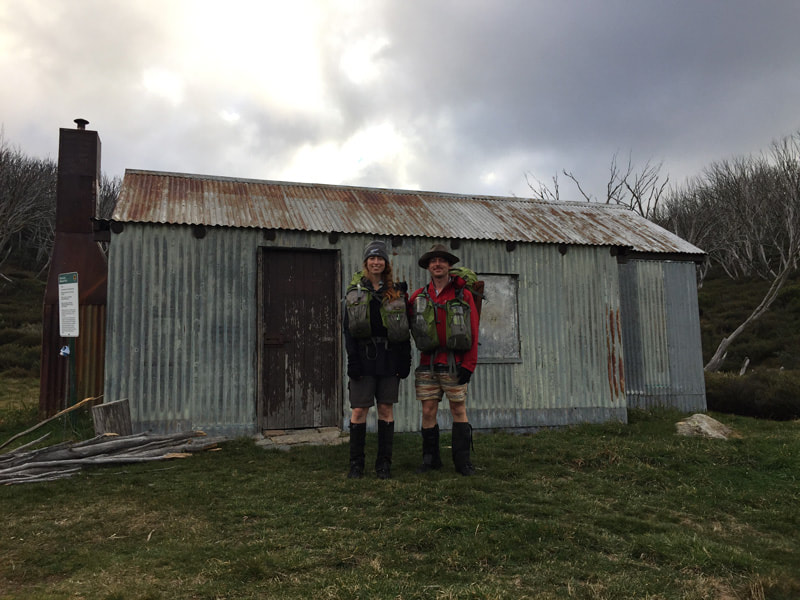
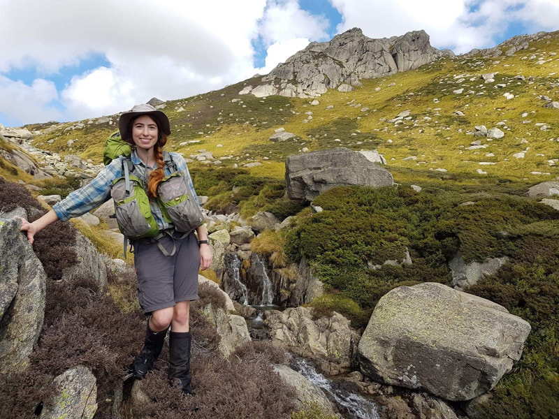
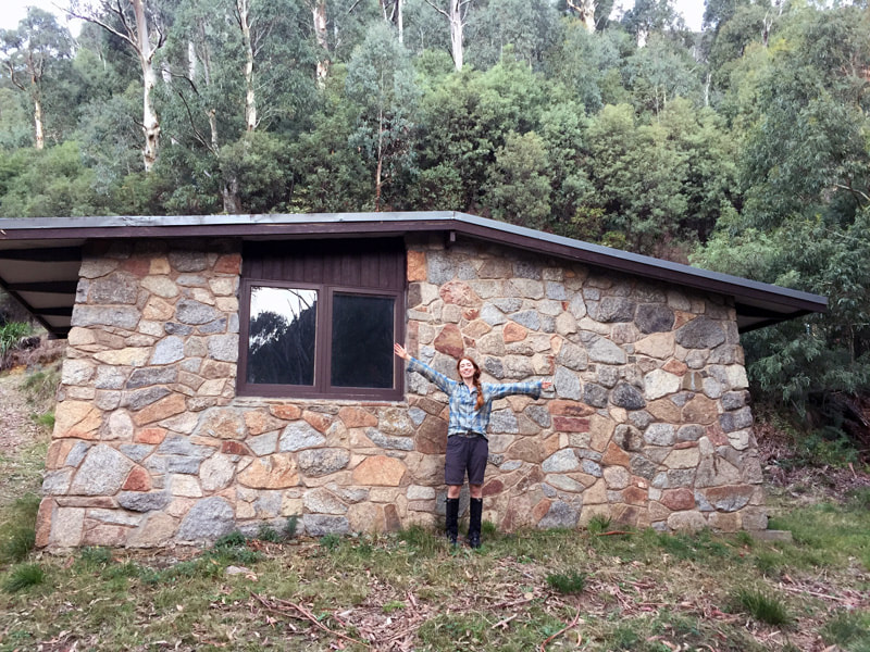
After a short descent down the final dam, we made it to the Opera House in all its glory. Not only did it have a mattress, but also a fireplace! We made a pizza and slept the sleep of the victorious that night.
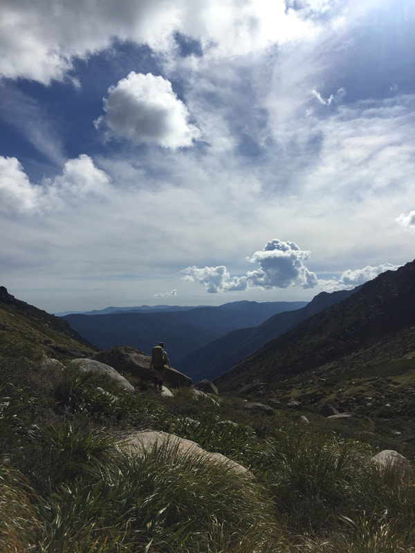
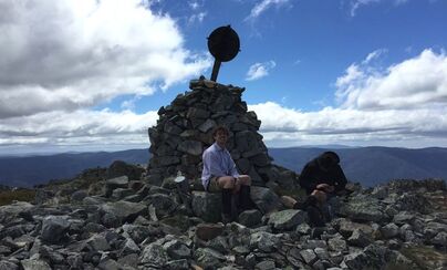
The next morning we had to climb back up the 1000 meters we’d descended the previous day. It was much less friendly on the knees, but it was still absolutely beautiful. After 3 hours we had had enough and decided to hike up the highest mountain we could see till we found a sealed path again. This might sound foolish but it actually worked perfectly. It saved us 4-5 hours of the next days hike and meant we could camp on Anton Anderson Saddle, marking the 2nd time in my life I have been the highest person asleep in Australia.
Anton Anderson Saddle
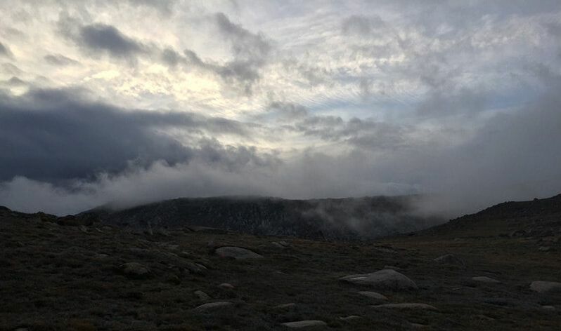
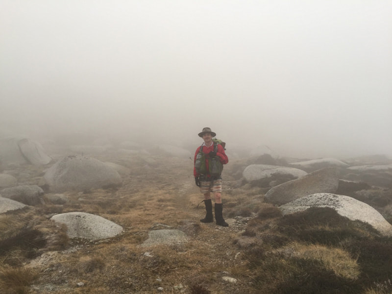
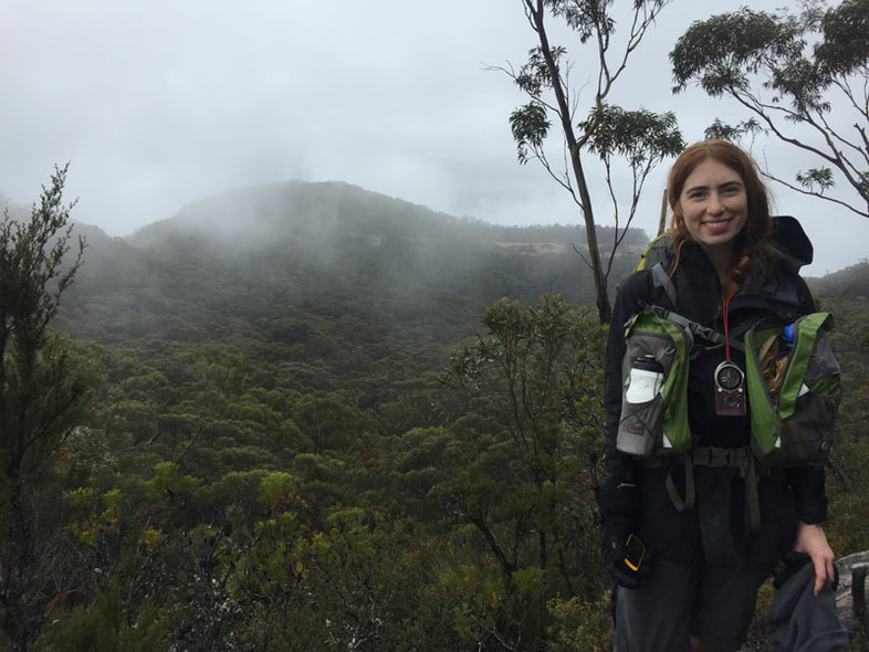
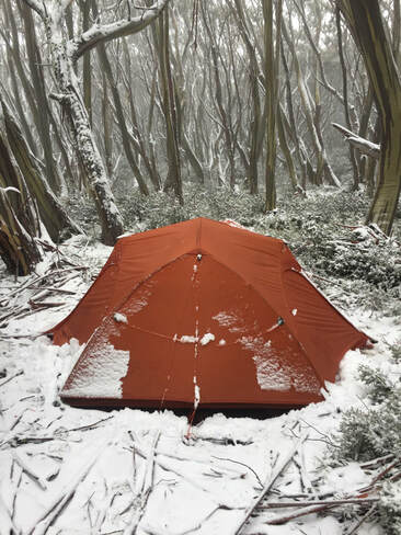
Day 3: Consett Stephens. Last time I hiked this pass I succumbed to fantastic knee pain and nearly to hypothermia. This time I was a lot fitter, more experienced and better prepared right? Wrong! It still beat the hell out of me. The beautiful scenery was instantly devoured by the swirling mists and the battering winds. However the elevated and exposed landscape does allow for some brief pockets of reception, and it was here we discovered that Michelle’s weather report that predicted sunny days and balmy weather in Kosciuszko was actually for Kosice in Slovakia (apparently you should write the whole name of the mountain into google..) Instead we should be expecting days of -6 degrees celcius with snow and rain.
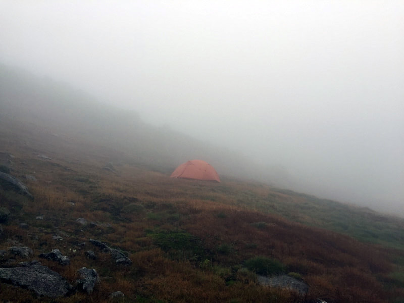
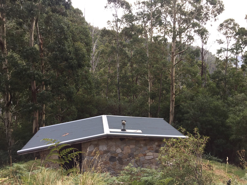
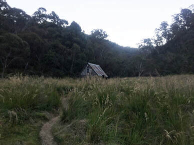
This meant that we had to cut our hike short if we were going to avoid getting frozen. After a brief bed-repair job at Whites River hut, we made our way to the charming Horse Camp hut, which is now my favourite hut of all time. We desperately wanted a fire, but didn’t have kindling, so with MacGyver as inspiration we blew up a lighter in the fireplace and soon enough we had fallen asleep reading a book in our cosy, warm hut.
Whites River Hut
The final day was a doosy! Two separate rangers drove by to warn us that the snow was a-coming and it really put the fear of god into us. We walked out onto the highway and hitched a couple of kms with two lovely men named Matt and Dave, then we were back into the belting winds on a race against time to get to the Thredbo chairlift before it closed at 4:30pm. It meant a 25km day with very short breaks, but we made it with 15 minutes to spare!...only to discover the chairlift hadn’t been running at all that day because of the intense weather. Fortunately there was a maintenance man at the top who had just finished his shift and gave us a ride down the mountain in time for a shower and a pub meal!
4 Comments
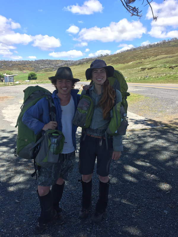
Okay, we’re back on the AAWT. Having already completed two weeks from Thredbo to Canberra, it was time to tackle the middle third from Thredbo to Hotham. After our first composition bootcamp as a musical duo, we caught a tram, then a train, then a bus and a car to Thredbo. We had allotted two weeks, and tried extra hard not to die, as our families would be twice as sad if we died before Christmas.
Mish’s dad Mick came with us for the first day. This meant that there were essentially three people with the same name and height… much confusion ensued. Our first day took us to Cascade hut where we spent our first glorious night reading Harry Potter and the Goblet of Fire on my Kindle.
Then came the second morning. Mick left in the pouring rain, while we bravely slept in until it had passed. It was a 20km day, no great ascents or descents, no bush bashing, no navigation, a little too easy if you ask me… That's why when the opportunity came for a 4km round trip through dense scrub to Tin Mine Waterfall, I was chomping at the bit.
Well folks, we never did find that waterfall, but on the plus side, I managed to lose the Kindle. Devastated. Not only about the pollution to our beautiful landscape, but we had only read the first chapter (which Harry isn’t even in). Now I know how Hugh Glass felt when he was crawling his way through America after being mauled by a bear with no food and profuse bleeding….Kindleless.
Anyway, we made it back to camp with our lives and though my pack was 200gms lighter, in reality it much heavier as the responsibility of providing our entertainment every night was now resting squarely on my shoulders. I knew the only way to atone for my mistake would be to concoct an original story far better than J.K. Rowling’s original masterpiece, as we walk up a mountain every day. Did I rise to the occasion? Yes, but more on that later.
Day three, we crossed Sam who was hiking the whole of the AAWT in the opposite direction. His brother was the one who was the avid hiker but pulled out just before they started with an injury. Sam who was originally the tag-on, decided to hike the 650kms by himself. Together we climbed… some mountain…oh I don’t know what it was called, they all blend into one after a while. (Mt Pilot, Michelle's edit)
Shortly afterwards we met Annie, who had hiked the whole AAWT, then decided to turn around and walk back again! I’d call her a nutcase, but she gave us a bottle of wine (from her own food drop), so she’s actually incredible.
We really needed ointment for some cuts and bites, and decided to hitchhike into Glen Wills. Fortunately a giant military tank picked us up and we zoomed out of the bush at an astonishing 30kms an hour. This marked the midpoint of our journey, which meant a day off!...well, almost.
We stayed with the Mayor of Glen Wills, aka Gordo, who runs the most gorgeous BnB he built himself. It’s a well known secret among AAWT hikers that 3kms from the track is a cheap night under a roof where the gracious host supplies you with beers and a roast!
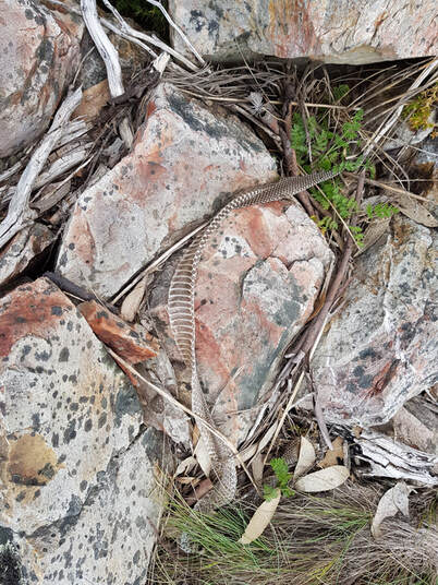
But you can’t stay forever, our itchy feet put us back on the track and finally the views came a-rolling in. Mt Wills was my favourite part of the whole thing; cool hut, gorgeous views, tonnes of fun rocks and it was cold! From here on out it was just incredible alpine walking with a bit of tricky navigation and the odd snake here or there. One meany gave us a big hiss and thoroughly scared us, it took us a few minutes figuring out how to get around her/him before we realised it’d run away ages ago.
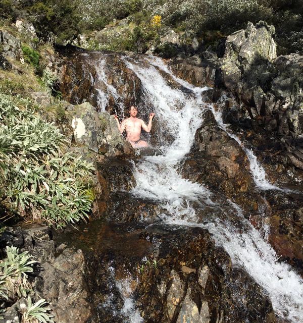
If you think this story is missing waterfalls and dingoes, you’re about to be satisfied. We saw a waterfall and a dingo! On the way to Cleve Cole Hut we’d heard about the nearby Howman falls. A waterfall provides a great opportunity for upperbody muscle building, which you can see all about here:
I’d like to tell you the adventure ends here, but alas it does not. Mother Nature was not content in taking my Kindle, she is a cruel mistress that demands regular sacrifice. This time it was my hat. It was an early Christmas present from Michelle, but then it became an early Christmas present for some mice, who wouldn’t even have looked half as good as I did in it. They ate my plastic bowl too!
Ahh well, it can be repaired. We found a hitch down from Hotham into Harrietville and it was once again time for a pub meal and wine.
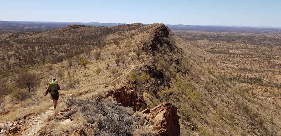
This was the first long distance hike I’d planned since the Australian Alps Walking Track and it could not have been more different. First of all because I was actually prepared this time! Mish and I had completed four additional smaller hikes by now, so not only was I feeling very fit but I actually own gear that fits me. 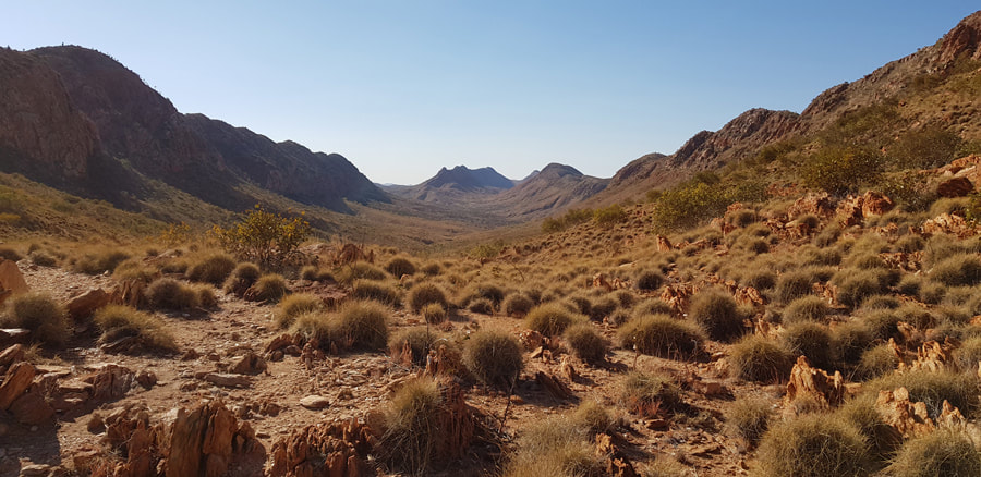 Looking east near Pioneer Creek After some initial research we found that the best time to complete the 230km hike is in June/July, because even in the winter the heat can be stifling. So naturally we began in late August. (Cue badass music). I’d never been to Alice Springs before, and there is certainly one word that comes to mind: Red. Its red, its just very very red. We stayed one night with our lovely friends Karen & Jacko, whom we know through the folk scene before being driven out by the Larapinta Trail Treck Support (LTTS) to Mt. Sonder. LTTS are a wonderful, yet tiny company. With only four full time workers, you can’t expect a prompt reply to your email, but they are genuinely dedicated to the track and to your safety, having made a pact that each member solo hikes the whole trek every few years.
The first day we climbed Mt. Sonder. The highest point along the hike at 1380m, its technically off of the trail, so while you don’t need to climb it you’d be a sucker not to. Speaking of suckers, we immediately found out how quickly you dehydrate in the Alice Springs sun. The walk simply wouldn’t be possible (for us whiteys) without the water tanks installed throughout the hike. Water was so plentiful all throughout the AAWT that you take it for granted. When we arrived in Alice it hadn’t rained for eight months and it showed! There were 5 or so beautiful gorges teaming with water, but on the whole the place was so dry and dusty, and did I mention red? 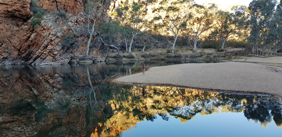 Ellery Creek waterhole You acclimatise though. Before long we’d learnt to leave by 7:30am and get the majority of our hiking finished before lunch, then relax for the hottest part of the day before hiking a little further before dinner. Every now and then we’d get lazy and sleep in, only to immediately be punished by the suns intense heat. If you walk in the heat, you have to replace the sweat you lose by carrying more water, which makes you sweat more…. Perhaps my favourite part of the whole thing was running into three Canberran scientists. They were reading the Deltora Quest series aloud on a kindle, and laughing hysterically at how poorly the series has aged in the 20 years since we were children. However fondly I had remembered the series, it was worth trading in my nostalgia for these three new friends, whose uncanny sense of humour and camaraderie made me look forward to every shared campsite. We even altered our itinerary so we could spend more time with them. 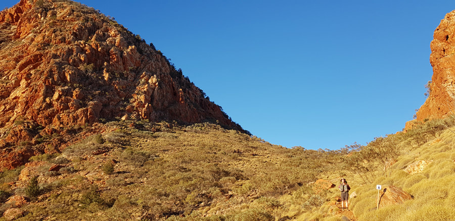 Saddle on the way to Brinkley Bluff One of the worst things about hikes is that they end, and the Lara was no different. If you walk East to West like we did, civilisation begins to loom in front of you for the last three days, while the splendor of the landscape tends to flatten out and the heat really beats down on you. We walked 50kms in two days to finish early and enjoy and ice-cream while rolling around on the first grass we’d seen in 15 days. Full gallery
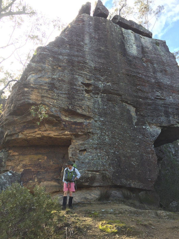
Right. My Turn. I’m leading this one. I grew up in the mountains. I know them like the back of my hand, right? Wrong! Having well and truly caught the hiking bug by now, I’d decided there must be an incredible long distance hike in the Blue Mountains, and I was only sort of right. For such an expansive and scenic location, there is very little in the way of overnight hikes in the Blue Mountains. After much research, I decided on the Kanangra to Katoomba, a three day, 45km hike, with plenty of splendor and a healthy amount of isolation. 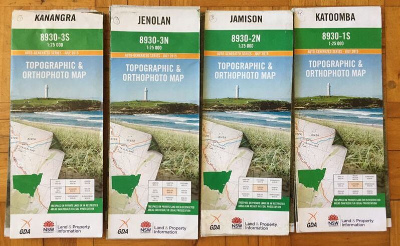 Map set for K2K With the full knowledge that I would be leading this hike, I looked up to the great leaders of history (ie: Jim Kirk) and meticulously plotted our itinerary on my newly purchased maps. Maybe had I spend a more time on logistics and a little less on making our own custom fantail wrappers, I wouldn’tve overlooked the 3 hour drive to get to Kanangra (thanks Mum) and we wouldn’tve spent so much time walking in the dark…
Well a little night walking never hurt anybody, or maybe just a few people, and it certainly wouldn’t stop Kirk, so off we went. Kanagra walls are just so incredible, they are already so remote themselves but as you descend into the thick bush you lose sight of the skyline and the feeling of isolation intensifies. Although we found evidence of other hikers, we never saw another soul. No hikers, no tourists, not even a wallaby. Instead we were treated to intense navigation through the bush when the path seemed to vanish, not to mention steep climbs and the bitter cold and rain. We never made our intended campsites, our delayed start was such a handicap that even after an hour or two of night walking we still had another two before we’d make camp, and those two feel like twenty when its raining.
On the second day we crossed the cox river, and after drying (and then warming) our feet, we found ourselves in the path of a wild pig. Cue the wild deer scene from Stand By Me, cue Sigur Ros’ ambient soundscapes so we can intimately reflect on the beauty of the wild. Cue absolute terror when we realise its coming straight for us. What do you do when a giant wild pig is headed straight for you? You hear about wild pigs that can run away with a hunting dog biting its rump until the dog suffocates, what the hell were we supposed to do. Well, we just stood there nervously and the pig ran away. Gripping stuff right? 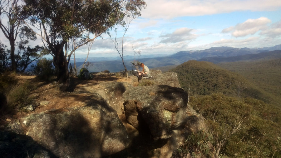 Lunch at the top of Tarros Ladder We didn’t make camp that night either, but one more day of walking till we reached Katoomba, only to find that we’d unwittingly walked a third of an even longer, even more isolated track! We’ll be back for it one day, but we were well due for a pub meal and a warm blanket. Full gallery
Mt. Bogong is Victoria’s highest mountain at 1986m. It doesn’t have the classic mountain point like Feathertop but instead flattens out on top with a gentle ascent to the summit (once you’ve done all the crazy climbing and made it to Hell Gap mind you). The views go on for miles, mountain range after mountain range. When hiking the AAWT on a clear day you can see more than a week ahead at this point, with Kosciuszko sitting on the horizon some 150km away.  A wee rest at the summit of Mt Bogong We drove into Camp Creek Gap and took Eskdale spur up to Bogong the next day. From this side there’s 3 ways to approach Mt Bogong. Here they are in order of most painful to least:
I’ve descended the Staircase before (it’s long, it’s steep) and would be interested in walking up it, but we had a long day ahead and needed to reach Mt. Bogong early if we were to have any chance of finding Cairn Creek hut again. So we chose Eskdale spur which has a couple of very steep parts but overall pretty good. We took a breather at my namesake hut ‘Michell’ which is about halfway, and then continued onto Mt. Bogong making good time; which we needed as we’d done our usual and not left the earliest. Quick break at the summit and then headed west down Quartz Ridge to the Cairn Creek turn off. 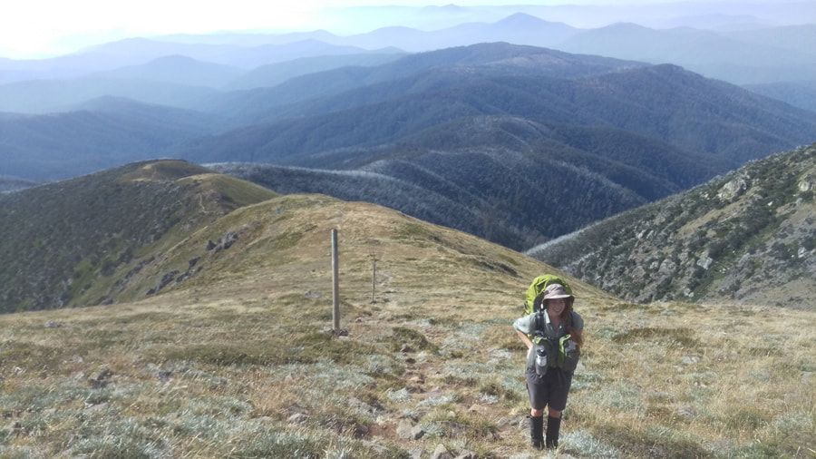 Eskdale Spur Cairn Creek hut was the first ‘elusive hut’ I wanted to find back in 2016. I managed it with the help of my friend Chris but it wasn’t easy - it’s only 2km from the main path but it took us 2hrs (have you ever walked 1km an hour because of terrain? It’s not easy). The hut was built by the SEC in 1952 to measure the results of a diversion intended for Big River, but the tunnel was never built.
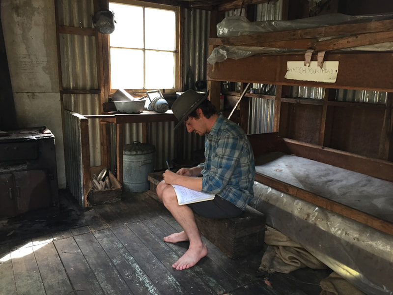
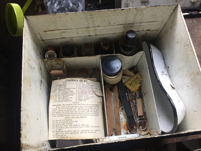
We were losing light and I wasn’t feeling as confident. The hut is at a junction of two rivers so if you come down at the right spot you should be able to see this, unfortunately this time we’d come down too far to the west and I wasn’t sure if we needed to go east or west, all I could see was one river. It was nearly 6pm at this point and getting close to head torch time. We decided to head east and scrambled up the bank for 100m. I was feeling very uncertain and went to turn around when Mickey saw the hut in front of us (probably because I move out of the way!). We then had to cross two rivers to get to it at about 6.15pm. Luckily neither was swollen and we only had to take off our shorts. 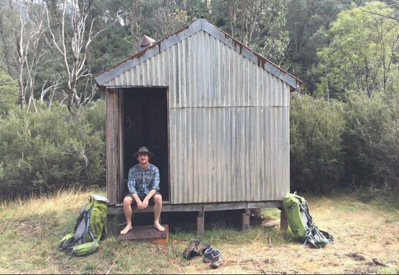 Cairn Creek Hut! Cairn Creek isn’t exactly the most amazing hut but you feel pretty good when you find it. It’s small with a little heater that has a smoking problem. There’s charming historical items in there including a first aid kit with ointments, bottles, a kidney bowl and instruction manual. There’s also various farming equipment, enamel bowels and a bunk bed you would not want to sleep on. The log book had a number of entries since 2016 but not many and the book goes back 20 years - in popular huts log books can change every year.
The 2nd day we made the hellish climb outta there, just getting to the main track before it started pouring. We took Timms Spur and walked through Big river with our shoes on because let’s face it, we were already wet. Luckily we had a nice ascent to keep us warm and the weather blew over soon after. We stayed at the lovely Ropers Hut that night. It burned down in 2003 and was reconstructed in 2008 using traditional techniques. It’s a very nice hut. The 3rd day was only 9km, but within that you descend 800m, cross Big River and ascend straight back up 800m! We left at a sprightly 12pm and rocked up to our destination, Cleve Cole, surprisingly late. Cleve Cole hut is a very well loved hut, I’m sure every other hut is extremely jealous of the attention it gets. Built in 1937 as a memorial to Cleve Cole, (who died skiing Mt Bogong after getting trapped in weather) this hut is maintained by the Bogong Club and has over 100 members.  Timms Spur, just after the rain cleared There’re bunks, toilets, a table, heater, sink, running water, stove (for members) and even a rudimentary shower. Unbeknown to us the Bogong club had an Easter holiday working bee on. I’ve never seen so many people cramped into a hut. Everyone was having a good time eating and drinking. They very nicely made space for us and offered the stove (they put the stove in because when there’re lots of people it’s dangerous to have so much cooking gear around). The locked room for members was open and random luxury items like guitars and sheet music came out. (Some poor person carried those up that spur…) Of course it soon became apparent that we were musicians and inevitably the guitar got passed over. Luckily Mickey can play guitar because I certainly can’t and for some reason there wasn’t a harp in the locked room. We settled on the Beatles book (of course) and a sing-a-long began. Mickey is a left-handed musician and it is to my great amusement that people pass him right handed instruments expecting him to play them - I can tell you that this never happens the other way round. He can play them though and remarkably well (I suppose that’s the result of being a minority). I feel a little sorry for him though as a lot of the time I’m the only one in the room who can appreciate the difficulty of playing up-side-down, and this was certainly the case 1760m up in a tiny cabin in the middle of nowhere with a group of hikers just wanting to hear their favourite Beatles tune. 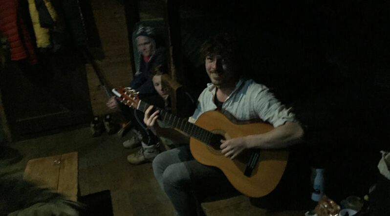 Cleve Cole jam 4th and last day we left Cleve Cole and headed back down Eskdale spur. A nice clear day it was great to descend with such fantastic views. We reached Camp Creek Gap after lunch and drove on outta there. This loop is truly fantastic with fantastic huts and views. Navigation (apart from Cairn Creek) is easy, you just need a bit of fitness for all the ascents/descents. x Full gallery 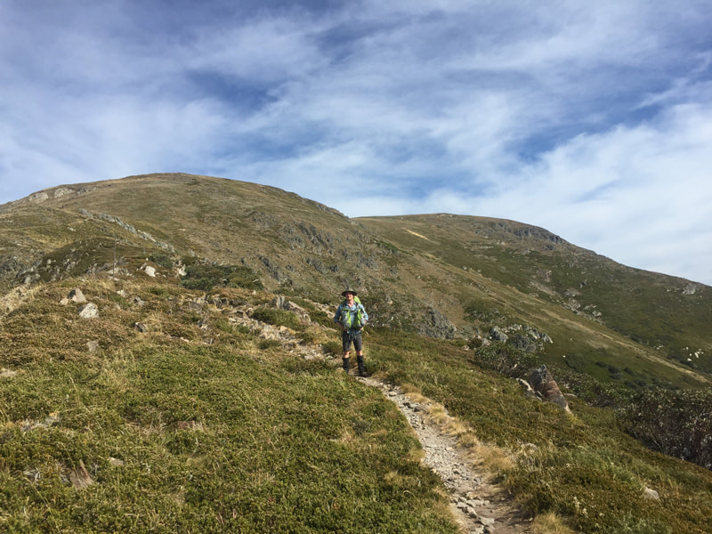 Heading down Eskdale spur 'The Australian Alps has around two hundred historic huts. With some dating from the 1860s, the huts come from every era of European history in the Australian Alps. They were built for simple shelter by graziers, gold miners, foresters, government workers, skiers and bushwalkers.' – theaustralianalps.wordpress.com 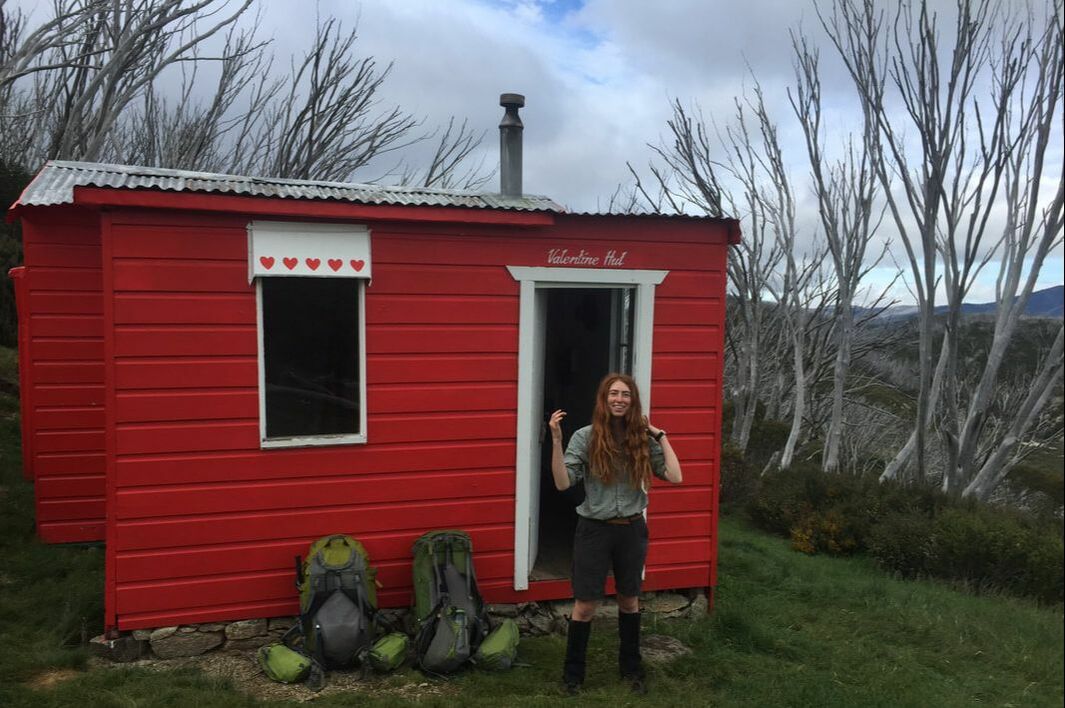 Valentine Hut, Main Range Kosciuszko My obsession with huts started back in 2013 when I first stayed at Federation hut next to Mt. Feathertop. Such an eye-opener when I realised that there were potential shelters other than a tent which came with a fireplace to keep warm/dry gear, (there’s always something damp) often a water tank and sometimes toilets. So much luxury. I then found out there are huts which are difficult to find. Even MORE exciting! Often these huts were built a long time ago for some ye-olde reason and have since become superfluous, so no one goes there anymore and the track overgrows as a result. 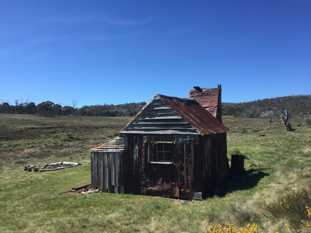 Four Mile Hut, AKA Hughes Hut Kosciuszko Huts Association (KHA) is a fantastic database, and one of my favourite sites, as you can puruse all the huts of the high country. My favourite part is when the description says ‘difficult to find’ followed by thrilling buzz words like ‘rock scramble’ or ‘dense scrub’. The next step is to look up blogs to see what people’s experiences are of finding the hut. There is nothing more exciting than seeing ‘3rd attempt to find the hut, still no luck’. I suppose at this point you might think that I have a problem? But hear me out; it’s really just one big Easter egg hunt, with the reward shelter and usually a nice place to camp. Sometimes there’re historical artefacts in there and a log book so you can see how few people have found it.
 View from Mt. Feathertop looking west Bringing in the New Year with a 3dayer hike (which was meant to be 4!) around Hotham. We started at Harrietville – this is easily my favourite mountain village, I have started and ended so many hikes here and couldn’t recommend the pub enough. We drove from Melbourne to Harrietville in the morning and started walking about 1pm. From Harrietville we took the Bungalow Spur up to Federation hut/Mt Feathertop. This is a really nice spur for an accent of 1300m over 12km - lots of switchbacks and a good slow incline, so you don’t burn yourself out.
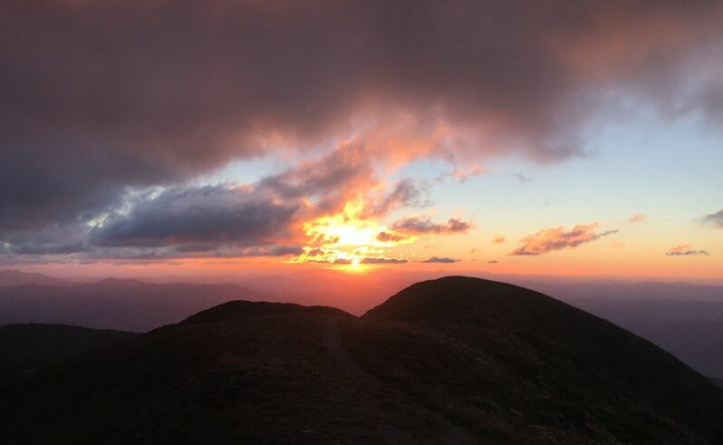
Made Federation hut with loads of light left (thank you summer) and set up camp. We then went up Feathertop without packs in time for the sunset. Best decision ever. It did mean walking back 1.5km with 300m of descent in the dark, but it was totally worth it. We then had an extremely late dinner (tuna mornay!) in the dark. We’re not really stereotypical hikers; the amount of times we leave late morning and eat dinner in the dark is ridiculous (and yes we are often judged by other hikers). The thing is that you can do your own thing, as long as you’re safe, warm and have food and water, it doesn’t really matter what you do. Still, there’s raised eyebrows when you show up to camp as the sun goes down. On the plus side, there's no judgement in the morning as everyone's left by 6am and you have the hut to yourself! 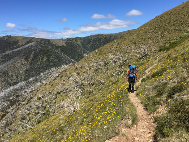 Razorback, nearly at Hotham 2nd day we walked along the Razorback to Hotham, then down Swindlers Spur to Dibbins hut for the night. Dibbins is one of my favourite huts. I’ve been there 6 times on various hikes. It’s pretty basic on the inside but so iconic on the outside and in the most beautiful alpine meadow. Unfortunately the famous Dibbins rat got into our packs and gnawed holes through the plastic food bags (just like that scene in Wallace and Gromit where Wallace tries to pour cereal but it comes out the other end where Shaun the sheep ate it). Mr Rat even tried to get through the peanut butter jar, thank god its teeth were no match for the plastic or else Mickey may have walked out then and there.
3rd day we headed north at Cobungra Gap and up past Blair Hut turning west at Diamantina spur. I’ve once been down this spur and I can definitely recommend ascending. (Dad doesn’t speak fondly of Diamantina spur... I enjoy bringing the name up around him because he has such a wonderful wide-eyed reaction: 'oh that spur' and then proceeds to relive the whole painful experience). Look it’s pretty steep in parts, and generally (for my knees sake) I’d rather be walking up the hill. Diamantina gets you back to the Razorback in Fed hut, but our destination that night was MUMC on the Northwest spur. This hut looks like something that could land on the moon. It stands for Melbourne Uni Mountaineering Club. Apparently members have extravagant events where they bring up instruments, fancy clothes, drinks and make pasta from scratch. 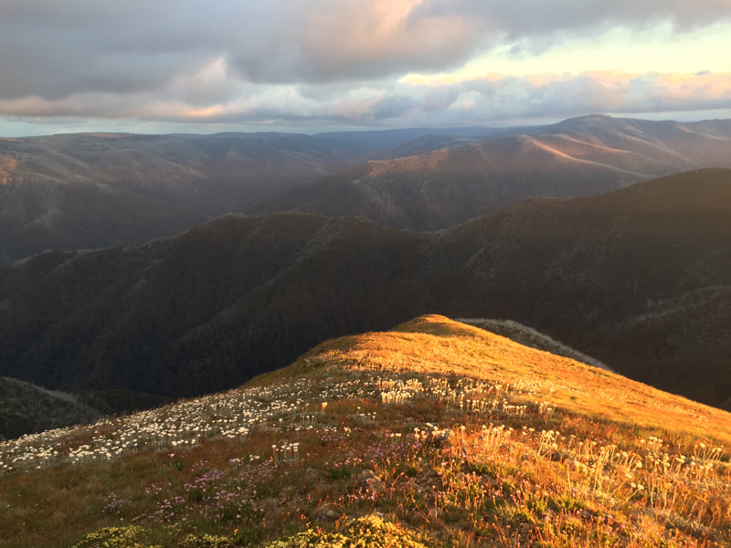 Wild flowers and mountains viewed from Feathertop We reached MUMC hut by 4.30pm for a well deserved rest. The plan was to stay the night, but a pub meal was calling us and we figured that it’d probably only take 1.5hrs to walk 5km down Northwest spur, which takes you to a main rd about 7km from Harrietville. So off we went. The track started out fine, but got more and more overgrown as we went. In fact it took us closer to 3hrs to get outta there, sometimes that just happens. It’s a pretty fun spur but needs a bit of clearing in parts. We made the rd by 8pm and luckily some locals offered us a lift into Harrietville where we made dinner by only a few mins! Would totally recommend this (almost) loop. You get to see some of the best mountains in Victoria. It’s definitely a hard hike with a lot of ascent/descent, but you could make it easier by taking more days. x
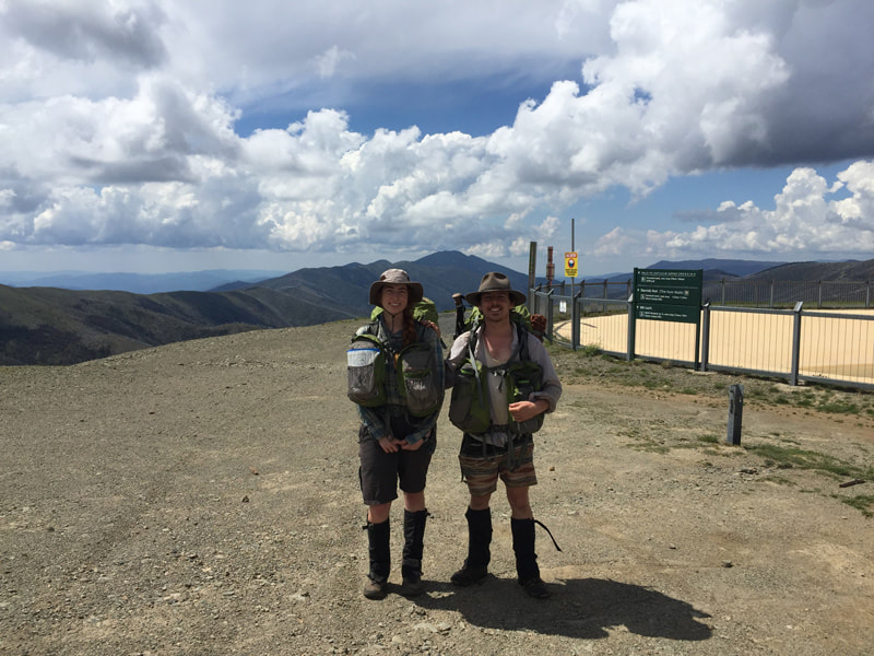
Full gallery To say I was unprepared for the AAWT would be an understatement. Mish called, saying she needed a new hiking partner for the final 3rd of her 650km hike from Victoria to Canberra. Having zero gear and even less experience, I felt like the perfect man for the job. 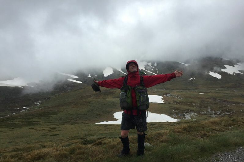 Main Range, Kosciuszko I had three days to quit my jobs, move out of my house and get down to Canberra for a lift to Thredbo. Once there it was decided my high school joggers with holes in them weren’t going to be sufficient, I bought some decent ones and was gifted my very first spork (a fetching hot pink). Before you knew it we were setting out from Thredbo the next morning. Before we’d even left though, a young hiker came back into town having decided to quit the hike after 400km, his leg pain and the weather proving too much for him. To prove this ill omen didn’t worry me, I held in the vomit that’d been trying to escape my body for the first 20 minutes (the cold and lack of sleep over the past few days catching up). It worked and I think I’d have made a very promising new companion to Michelle if I hadn’t been holding my compass upside down.
But eventually I adapted. The long walks and the incredible cold make the warm food and sleeping bag at the end of the day all the more comforting. On the second night, we were somewhat forced into becoming the two most elevated sleepers in Australia, having lost the track over the Main Range in the snow. A brief flirtation with hypothermia was not enough to take away from the astonishing views and the incredible feeling of your body becoming an energy burning, mountain ascending machine. There is something very satisfyingly primal about a lack of reception, screens or even standards of cleanliness (the latter of which I’ve never particularly adhered to anyway). Long stretches of isolation, no news from the outside world and fresh food, people always ask me if I got bored but honestly, there was no time to. With all the planning, the eating and 8 hour plus of sleep every night, boredom just wasn’t an option. Not to mention that when you know you're walking to Canberra, every kilometer comes with a tremendous sense of worth.  Just doing a spot of housework Then all of a sudden the hike was over. It was a very rude shock. During the hitch into town our driver told us that gay marriage was passed (finally)! Somehow society didn’t collapse and I was able to enjoy my first shower in 15 days. I’ve definitely got the bug, so stay tuned for more of my zany adventures of ill-preparation in the mountains!
Full gallery
Now this was a biggy. I remember first finding out about this hike when I was 23. My dad took me on a 3 day hike up Mt Feathertop, finishing at Mt Hotham. I was absolutely blown away. As we walked higher and the trees started to thin out to beautiful alpine meadows I remember thinking ‘this is it, these are the places I want to know more about.’
For some background, the AAWT is a 650km hike of mountainous and often remote walking from Walhalla (VIC) to Tharwa (ACT) across the great diving range. I spent a year planning and preparing for it with my friend Chris. To my complete surprise and pleasure I managed to complete it on the 18th of December 2017 in 43 days! It was an epic challenge to say the least and touch and go in parts managing injuries. I had a surprise hiking partner change 2/3rds into the hike which found Mickey on his first overnighter, which just happened to be 212km! 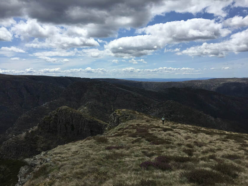 Mt Howitt Yes yes the hike changed me and all that, I just don't think that you can do something this out of your comfort zone and not have it affect you? I definitely came back wanting more. I have since decided that some of the more rewarding experiences come with being a little apprehensive and uncomfortable (physically and mentally). Couldn't recommend it enough. x
click for full gallery |
AuthorMickey or Michelle, depending who has more to say on the subject :) Archives
March 2020
Categories
All
|

 RSS Feed